place

Leschaux Hut

French building and structure stubsMountain huts in FranceMountain huts in the Alps
Refuge de Leschaux
Refuge de Leschaux

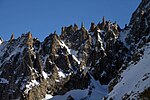
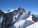
The Leschaux Hut (French: Refuge de Leschaux) is a refuge in the Mont Blanc massif in the Alps. It is located at 2,431 m on the north side of the Glacier de Leschaux – a tributary of the Mer de Glace. It is owned by the CAF and can accommodate up to 19 people. The hut is used as a base by mountaineers climbing peaks such as Grandes Jorasses, Petites Jorasses and Mont Mallet. It is accessed by going up the Mer de Glace from Montenvers, and then up the Glacier de Leschaux.: 33 : 314  The first refuge was built in 1929. It was enlarged to 30 seats in 1934, but destroyed by an avalanche in 1954. A new hut was built in 1968 and was enlarged in 2003.

Excerpt from the Wikipedia article Leschaux Hut (License: CC BY-SA 3.0, Authors, Images).

Leschaux Hut
Les Balcons de la Mer de Glace, Bonneville

Geographical coordinates (GPS) Address Phone number Website External links Nearby Places
placeShow on map

Wikipedia: Leschaux HutContinue reading on Wikipedia

Geographical coordinates (GPS)

Latitude Longitude
N 45.895277777778 ° E 6.9802777777778 °
placeShow on map

Address

Refuge de Leschaux

Les Balcons de la Mer de Glace
74400 Bonneville
Auvergne-Rhône-Alpes, France
mapOpen on Google Maps

Phone number
Club Alpin Français

call+33636953264

Website
refugeleschaux.ffcam.fr

linkVisit website

linkWikiData (Q1578333)
linkOpenStreetMap (97321426)

Refuge de Leschaux
Refuge de Leschaux
Share experience

Nearby Places

Dent du Géant
Dent du Géant

The Dent du Géant (It.: Dente del Gigante, "giant's tooth") (4,013 m) is a mountain in the Mont Blanc massif in France and Italy. The Dent du Géant remained unclimbed during the golden age of alpinism, and was a much-coveted peak in the 1870s, repelling many parties who attempted it mostly from the Rochefort ridge. In 1880 the strong team of Albert F. Mummery and Alexander Burgener tried to force a passage via the south-west face but were repelled by a band of slabs, causing Mummery to exclaim, 'Absolutely inaccessible by fair means!'The mountain has two summits, 88 feet (27 m) apart and separated by a small col (an 'extremely awkward notch' according to W. W. Graham): Pointe Sella (4,009 m), first ascent via the south-west face by Jean Joseph Maquignaz with son Baptiste Maquignaz and nephew, Daniel Maquignaz on 28 July 1882. Over a period of four days they placed iron stanchions and fixed ropes, enabling the same party to climb Pointe Sella a second time on the following day with clients Alessandro Sella, Alfonso Sella, Corradino Sella and Gaudenzio Sella. Pointe Graham (4,013 m), first ascent by W. W. Graham with guides Auguste Cupelin and Alphonse Payot on 20 August 1882. They used the fixed ropes of "Sella's staircase" to repeat the ascent of Pointe Sella, where Graham noted that one of the Maquignazes had carved the letter 'M' on a rock step. They then lowered themselves 12 metres (39 ft) into the col to climb this higher north-east peak.This ascent marked the end of the so-called silver age of alpinism. On 28 July 1935 the Austrian climbers Herbert Burggasser and Rudi Leitz first ascended the vertical-to-overhanging 160 m-high south face. It was the first climb in the Western Alps systematically aided by the pitons and artificial techniques that were already in use by climbers in the Eastern Alps.During a heat wave in the summer of 2019, a glaciological rarity in the form of a previously unseen lake emerged at the foot of the Dent du Géant, the Aiguilles Marbrées and the Col de Rochefort at an altitude of about 3400 meters, that was considered as evidence for the effects of global warming on the glaciers in the Alps.The following facilities serve the mountain: Torino Hut (3,375 m, CAI, all year) Pointe Helbronner (3,462 m, téléphérique station for Skyway Monte Bianco)