place

Badley

Civil parishes in SuffolkMid Suffolk DistrictOpenDomesdaySuffolk geography stubsVillages in Suffolk
Badley Church of St Mary

Badley is a village and civil parish in Suffolk, England. It is located between Stowmarket and Needham Market, in the Mid Suffolk district. With an electorate of less than 100, it has an infrequent parish meeting rather than a parish council. The population is included in the town of Needham Market. Badley is listed as a settlement with 41 households in the 1086 Domesday Book.

Excerpt from the Wikipedia article Badley (License: CC BY-SA 3.0, Authors, Images).

Badley
Stowmarket Road, Mid Suffolk

Geographical coordinates (GPS) Address Nearby Places
placeShow on map

Wikipedia: BadleyContinue reading on Wikipedia

Geographical coordinates (GPS)

Latitude Longitude
N 52.1715362 ° E 1.0209354 °
placeShow on map

Address

Stowmarket Road

Stowmarket Road
IP6 8RT Mid Suffolk
England, United Kingdom
mapOpen on Google Maps

Badley Church of St Mary
Share experience

Nearby Places

Suffolk Wildlife Trust

Suffolk Wildlife Trust (SWT) describes itself as the county's "nature charity – the only organisation dedicated wholly to safeguarding Suffolk's wildlife and countryside." It is a registered charity, and its headquarters is at Brooke House in Ashbocking, near Ipswich. It was founded in 1961, and is one of 46 wildlife trusts covering the Great Britain and Northern Ireland. As of March 2017, it has 13,200 members, and it manages 3,120 hectares (7,700 acres) of land in 60 nature reserves, most of which are open to the public. It had an income of £3.9 million in the year to 31 March 2017.Suffolk is a county in East Anglia. It is bounded by Norfolk to the north, Cambridgeshire to the west, Essex to the south and the North Sea to the east. With an area of 1,466 square miles (3,800 km2), it is the eighth largest county in England, and in mid-2016 the population was 745,000. The top level of local government is Suffolk County Council, and below it are five borough and district councils: Babergh, Ipswich, Mid Suffolk, East Suffolk, West Suffolk. Much of the coast consists of the estuaries of the Orwell, Stour, Alde, Deben and Blyth rivers, with large areas of wetlands and marshes. Agriculture and shipping play a major role in the county's economy.The whole or part of nine SWT reserves are Ramsar internationally important wetland sites, thirty-one are Sites of Special Scientific Interest, four are national nature reserves, ten are Special Protection Areas, ten are Special Areas of Conservation, seven are Nature Conservation Review sites, one contains a scheduled monument and three are local nature reserves. One SWT reserve is in Dedham Vale, which is an Area of Outstanding Natural Beauty (AONB), and seven are in another AONB, Suffolk Coast and Heaths.

List of local nature reserves in Suffolk

Suffolk is a county in East Anglia. It is bounded by Norfolk to the north, Cambridgeshire to the west and Essex to the south. With an area of 1,466 square miles (3,800 km2), it is the eighth largest county in England, and in mid-2016 the population was 745,000. At the top level of local government is Suffolk County Council, and below it are five borough and district councils: Ipswich, East Suffolk, Mid Suffolk, Babergh and West Suffolk. Much of the coast consists of the estuaries of the Orwell, Stour, Alde, Deben and Blyth rivers, with large areas of wetlands and marshes.Local nature reserves (LNRs) are designated by local authorities under the National Parks and Access to the Countryside Act 1949. The local authority must have a legal control over the site, by owning or leasing it or having an agreement with the owner. LNRs are sites which have a special local interest either biologically or geologically, and local authorities have a duty to care for them. They can apply local bye-laws to manage and protect LNRs.As of August 2017 there are 36 LNRs in the county. Three are in Areas of Outstanding Natural Beauty, seven are Sites of Special Scientific Interest, one is a Nature Conservation Review site and two are managed by the Suffolk Wildlife Trust. The largest LNR is Sudbury Common Lands with 50.3 hectares (124 acres), which has ancient wetlands, and the smallest is Alderman Canal West at 1.0 hectare (2.5 acres), which has rare wetland flora.

List of Sites of Special Scientific Interest in Suffolk

Suffolk is a county in East Anglia. It is bounded by Norfolk to the north, Cambridgeshire to the west, Essex to the south and the North Sea to the east. With an area of 1,466 square miles (3,800 km2), it is the eighth largest county in England, and in mid-2016 the population was 745,000. At the top level of local government is Suffolk County Council, and below it are 5 borough and district councils: Babergh, Ipswich, Mid Suffolk, West Suffolk and East Suffolk. Much of the coast consists of the estuaries of the Orwell, Stour, Alde, Deben and Blyth rivers, with large areas of wetlands and marshes. Agriculture and shipping play a major role in the county's economy.In England, Sites of Special Scientific Interest (SSSIs) are designated by Natural England, a non-departmental public body which is responsible for protecting England's natural environment. Designation as an SSSI gives legal protection to the most important wildlife and geological sites. As of October 2017 there are 142 SSSIs in Suffolk, of which 109 are biological, 28 geological and 5 are designated under both criteria. One site is in the Dedham Vale, an Area of Outstanding Natural Beauty (AONB), and thirty-six are in another AONB, Suffolk Coast and Heaths. There are thirty-three Geological Conservation Review sites, twenty-three Nature Conservation Review sites, twenty Special Areas of Conservation, thirty Special Protection Areas under the European Union Directive on the Conservation of Wild Birds, eight Ramsar internationally important wetland sites, seven national nature reserves and four contain scheduled monuments. Six sites are local nature reserves, twenty-seven are managed by the Suffolk Wildlife Trust, five by the Royal Society for the Protection of Birds and one by the National Trust. The largest is Breckland Forest at 18,126-hectare (44,790-acre), which is partly in Norfolk and has several invertebrates on the IUCN Red List of Threatened Species, and the smallest is a 0.1-hectare (0.25-acre) meadow in London Road Industrial Estate, Brandon, which has the largest known wild population in Britain of the nationally rare sunflower Artemisia campestris.

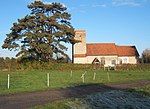
Stowupland
Stowupland

Stowupland is a village 1 mile (2 km) east of Stowmarket, Suffolk, England. Stowupland means "a place occupied on higher ground than Stowmarket", with the Saxons calling the village Ultuna due to the far higher presence of owls in the woods that previously stood on the site of Holy Trinity Church ('Ul' meaning owl). Stowupland High School is found in the village. Stowupland is centred on several village greens and has numerous amenities including, a petrol station, a butchers, a Chinese takeaway, a chip shop and two public houses - The Crown and The Retreat. As well as the High School there is Freeman Community Primary School, which has an attached pre-school. There are active football, cricket and bowls clubs in the village. A lottery grant funded gym and indoor sports facility is available for public use at the high school. The village implements a "Parish Plan" to help steer the development of the village. The plan was produced following the completion and analysis of a questionnaire that was sent to every dwelling and allows residents to have a degree of say in what happens in the village. One of the main aims is to try to maintain Stowupland's separation from the nearby market town of Stowmarket which has expanded considerably in recent years with just a single field now separating properties in Stowmarket from Stowupland. A monthly magazine, "The Telstar", is delivered free to every household and contains reports from parish and local council as well as various articles from residents, clubs and churches in the village. Stowupland previously hosted an event (Music on The Green) which took place in June each year. Due to lack of interest (occasional bad weather) the event was discontinued. The A1120 tourist route runs through the village and the A14 trunk road is located just to its south.