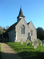
Compton Down, Compton
Geography of West Sussex

Compton Down is an extent of high ground near Compton, West Sussex where there was an Admiralty semaphore station. The semaphore station was built at Compton Down in 1821 and it operated on the semaphore line from London to Portsmouth between 1822 and 1847. The hill to the east of Compton on which the semaphore was built is now known as Telegraph Hill. The high ground to the west of Compton retains the name of Compton Down. Both hills rise to above 500 feet (150 m).
Excerpt from the Wikipedia article Compton Down, Compton (License: CC BY-SA 3.0, Authors, Images).Compton Down, Compton
Compton Down Road, Chichester Compton
Geographical coordinates (GPS) Address Nearby Places Show on map
Geographical coordinates (GPS)
| Latitude | Longitude |
|---|---|
| N 50.92872 ° | E -0.912 ° |
Address
Compton Down Road
PO18 9NW Chichester, Compton
England, United Kingdom
Open on Google Maps


