Hinchinbrook, New South Wales

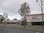
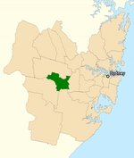
Hinchinbrook is a suburb of Sydney, in the state of New South Wales, Australia. Hinchinbrook is located 35 kilometres south-west of the Sydney central business district, in the local government area of the City of Liverpool. It is bordered by Hoxton Park and Green Valley. The main shopping precinct features the Valley Plaza. Schools include Hoxton Park High School, Hinchinbrook Public School, Good Samaritan Catholic College and James Busby High School. It is also homes to various clubs, such as the Uruguyan Social Sporting Club. Population has boomed as a result of new housing developments. New facilities have been developed to cater for the area, most notably the M7 Motorway.
Excerpt from the Wikipedia article Hinchinbrook, New South Wales (License: CC BY-SA 3.0, Authors, Images).Hinchinbrook, New South Wales
Egret Place, Sydney Hinchinbrook
Geographical coordinates (GPS) Address Nearby Places Show on map
Geographical coordinates (GPS)
| Latitude | Longitude |
|---|---|
| N -33.915 ° | E 150.868 ° |
Address
Egret Place
Egret Place
2168 Sydney, Hinchinbrook
New South Wales, Australia
Open on Google Maps


