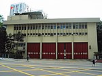
Tsing Yi Promenade
Commons link is defined as the pagenameHong Kong geography stubsTsing YiUrban public parks and gardens in Hong KongUse Hong Kong English from August 2020

Tsing Yi Promenade (Chinese: 青衣海濱公園) is a promenade along the northeastern seafront of Tsing Yi Island, Hong Kong. It was built in stages from 2001 to 2004.The Promenade faces Rambler Channel, from Greenfield Garden, through Tsing Yi Pier and Maritime Square to Cheung Fat Estate. At the end of this promenade is the Tsing Yi Northeast Park. The promenade spans 1,800 metres (5,900 ft) and occupies 6.6 hectares (16 acres) along the waterfront. Many people use this as a recreational area for jogging, exercising, and practising T'ai chi. There is a marvellous sea view for people to enjoy at night.
Excerpt from the Wikipedia article Tsing Yi Promenade (License: CC BY-SA 3.0, Authors, Images).Tsing Yi Promenade
Fung Shue Wo Road,
Geographical coordinates (GPS) Address Nearby Places Show on map
Geographical coordinates (GPS)
| Latitude | Longitude |
|---|---|
| N 22.3537 ° | E 114.1095 ° |
Address
青衣碼頭總站 Tsing Yi Ferry Bus Terminus
Fung Shue Wo Road
, Tsing Yi Town Centre
Hong Kong, China
Open on Google Maps


