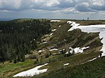
Stübenwasen
Mountains and hills of Baden-WürttembergMountains and hills of the Black ForestOne-thousanders of Germany

The Stübenwasen (1,386 m above sea level (NHN)) is the sixth highest mountain in the Black Forest after the Feldberg (1,493 m above NHN), Baldenweger Buck (1,461 m above NHN), Seebuck (1,448 m above NHN), Herzogenhorn (1,415 m above NHN) and the Belchen (1,414 m above NHN). It is the highest point on the ridge between Schauinsland and Feldberg and is only separated from the latter by a wide saddle. To the north is the St. Wilhelm Valley, to the south the Wiesental with Todtnau and Todtnauberg.
Excerpt from the Wikipedia article Stübenwasen (License: CC BY-SA 3.0, Authors, Images).Stübenwasen
Hämmerleweg,
Geographical coordinates (GPS) Address Nearby Places Show on map
Geographical coordinates (GPS)
| Latitude | Longitude |
|---|---|
| N 47.8676 ° | E 7.9715 ° |
Address
Hämmerleweg
79674
Baden-Württemberg, Germany
Open on Google Maps


