Rohrenkopf
BadenLörrach (district)Mountains and hills of Baden-WürttembergMountains and hills of the Black ForestOne-thousanders of Germany
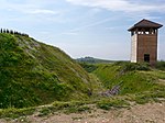
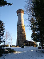
The Rohrenkopf is a mountain, 1,169.8 m above sea level (NHN) high, in the Southern Black Forest in Germany. It rises within the parish of Gersbach, a village in the borough of Schopfheim.
Excerpt from the Wikipedia article Rohrenkopf (License: CC BY-SA 3.0, Authors).Rohrenkopf
Rohrenkopfweg, Verwaltungsgemeinschaft Schopfheim
Geographical coordinates (GPS) Address Nearby Places Show on map
Geographical coordinates (GPS)
| Latitude | Longitude |
|---|---|
| N 47.713055555556 ° | E 7.9272222222222 ° |
Address
Rohrenkopfweg
Rohrenkopfweg
79650 Verwaltungsgemeinschaft Schopfheim
Baden-Württemberg, Germany
Open on Google Maps


