Municipal Borough of Ealing
Districts abolished by the London Government Act 1963Districts of England created by the Local Government Act 1894HanwellHistory of local government in MiddlesexHistory of the London Borough of Ealing ... and 4 more
Local Government Districts created by the Local Government Act 1858Municipal boroughs of EnglandNortholtPerivale

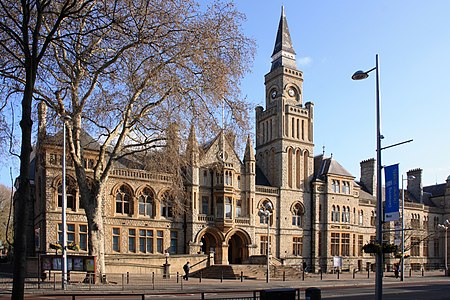
Ealing was a local government district from 1863 to 1965 around the town of Ealing which formed part of the built up area of London until 1965, where it became part of Greater London.
Excerpt from the Wikipedia article Municipal Borough of Ealing (License: CC BY-SA 3.0, Authors, Images).Municipal Borough of Ealing
Longfield Avenue, London
Geographical coordinates (GPS) Address Nearby Places Show on map
Geographical coordinates (GPS)
| Latitude | Longitude |
|---|---|
| N 51.513 ° | E -0.3076 ° |
Address
Ealing Town Hall
Longfield Avenue
W5 2AZ London (London Borough of Ealing)
England, United Kingdom
Open on Google Maps


