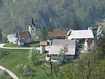
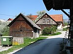
Dolenja Vas, Zagorje ob Savi
Pages with Slovene IPAPopulated places in the Municipality of Zagorje ob SaviZagorje ob Savi geography stubs
Dolenja Vas (pronounced [dɔˈleːnja ˈʋaːs]; Slovene: Dolenja vas) is a settlement in the Municipality of Zagorje ob Savi in central Slovenia. It extends from the western outskirts of Zagorje ob Savi to the left bank of the Sava River. The area is part of the traditional region of Upper Carniola. It is now included with the rest of the municipality in the Central Sava Statistical Region.
Excerpt from the Wikipedia article Dolenja Vas, Zagorje ob Savi (License: CC BY-SA 3.0, Authors).Dolenja Vas, Zagorje ob Savi
Dolenja vas,
Geographical coordinates (GPS) Address Nearby Places Show on map
Geographical coordinates (GPS)
| Latitude | Longitude |
|---|---|
| N 46.13235 ° | E 14.990291666667 ° |
Address
Dolenja vas
Dolenja vas
1410
Slovenia
Open on Google Maps


