place

Arthur Kill Road

Streets in Staten Island
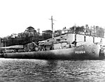
ARTHUR KILL ROAD IN STATEN ISLAND, LOOKING SOUTH. PRIVATE HOUSES ARE ALMOST ENGULFED BY ENCROACHING INDUSTRIES. IN... NARA 552013

Arthur Kill Road is a major northeast-southwest artery along the South-West Shore of the New York City borough of Staten Island. It is 8.54 miles (13.74 km) long, and runs through the neighborhoods of Tottenville, Richmond Valley, Charleston, Rossville, Woodrow, Huguenot, Arden Heights, Annadale, Eltingville, Greenridge, Great Kills, and Richmondtown. Arthur Kill Road is named for the waterway to its west, the Arthur Kill, which separates Staten Island from Union County and Middlesex County, New Jersey. It was known by other names in the 19th century, including Fresh Kills Road, Shore Road and Riverside Avenue. Landmarks include the Blazing Star Burial Ground, the Arthur Kill Correctional Facility, the unused LNG tanks east of Chemical Lane, the Kreischer House as well as the Outerbridge Crossing which Arthur Kill Road passes underneath.

Excerpt from the Wikipedia article Arthur Kill Road (License: CC BY-SA 3.0, Authors, Images).

Arthur Kill Road
Veterans Road East, New York Staten Island

Geographical coordinates (GPS) Address Nearby Places
placeShow on map

Wikipedia: Arthur Kill RoadContinue reading on Wikipedia

Geographical coordinates (GPS)

Latitude Longitude
N 40.555877777778 ° E -74.202222222222 °
placeShow on map

Address

Veterans Road East

Veterans Road East
10309 New York, Staten Island
New York, United States
mapOpen on Google Maps

ARTHUR KILL ROAD IN STATEN ISLAND, LOOKING SOUTH. PRIVATE HOUSES ARE ALMOST ENGULFED BY ENCROACHING INDUSTRIES. IN... NARA 552013
Share experience

Nearby Places

Aspen Knolls

Aspen Knolls Estates is a private community in Staten Island, New York City. It contains 944 single-family town homes and is located in the neighborhood of Arden Heights on the island's south shore, near the intersection of Arthur Kill and Woodrow Road. The development of the community was originally for Navy Housing. Plans for this community began in the mid-1980s following the closing of the Saint Michael's orphanage (1982) with some of the land set aside for a church. The church also maintained a convent for the Presentation Sisters on the east side of the property. The church, now closed, and its grounds are surrounded on three sides by the Aspen Knolls Estates community, and by Arthur Kill Rd. on its fourth side. The Aspen Knolls Estates community was originally meant for housing of Navy families. However, due to Base Realignment and Closure, the housing contract was terminated in November 1994 after the closure of the Staten Island Homeport in Stapleton. With the community already planned, its builders decided to go through with construction and sell the homes to regular citizens. Construction began in 1995 and was finished in early 2006. During this time period, people moved into the community as each house was finished being built. The community today has over 4,000 residents. Surrounding two sides of this development (alongside the rear of homes lining Ilyssa Way from Arthur Kill Road to Woodrow Avenue.) is Arden Woods, with almost 200 undeveloped acres of forest and wetland, including some hiking trails.

Hudson River Waterfront Walkway

The Hudson River Waterfront Walkway, also known as the Hudson River Walkway, is a promenade along the Hudson Waterfront in New Jersey. The ongoing and incomplete project located on Kill van Kull and the western shore of Upper New York Bay and the Hudson River was implemented as part of a New Jersey state-mandated master plan to connect the municipalities from the Bayonne Bridge to the George Washington Bridge with an urban linear park and provide contiguous unhindered access to the water's edge. There is no projected date for its completion, though large segments have been built or incorporated into it since its inception. The southern end in Bayonne may eventually connect to the Hackensack RiverWalk, another proposed walkway along Newark Bay and Hackensack River on the west side of the Hudson County peninsula, and form part of a proposed Harbor Ring around the harbor. Its northern end is in Palisades Interstate Park, allowing users to continue along the river bank and alpine paths to the New Jersey/New York state line and beyond. (A connection to the Long Path, a 330-mile (530 km) hiking trail with terminus near Albany, is feasible.) As of 2007, eleven miles (18 km) of walkway have been completed, with an additional five miles (8 km) designated HRWW along Broadway in Bayonne. A part of the East Coast Greenway, or ECG, a project to create a nearly 3000-mile (4828 km) urban path linking the major cities along the Atlantic coast runs concurrent with the HRWW.In 2013 the walkway showed signs of age. Some of the pilings on which it is built succumbed to marine worms and effects of Hurricane Sandy in New Jersey, which undermined bedding.