Cowan, New South Wales
Hawkesbury RiverHornsby ShireSuburbs of SydneyTowns in New South WalesUse Australian English from August 2019

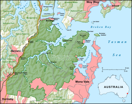
Cowan is a small outer suburb of Sydney, in the state of New South Wales, Australia, approximately 40 kilometres (25 mi) north of the Sydney central business district, in the local government area of Hornsby Shire. Cowan shares the postcode of 2081 with Berowra. Brooklyn, which lies 6 kilometres (3.7 mi) to the north-east of Cowan, is considered the northernmost suburb of the Greater Sydney Metropolitan Area.
Excerpt from the Wikipedia article Cowan, New South Wales (License: CC BY-SA 3.0, Authors, Images).Cowan, New South Wales
Carissa Place, Sydney
Geographical coordinates (GPS) Address Nearby Places Show on map
Geographical coordinates (GPS)
| Latitude | Longitude |
|---|---|
| N -33.59072 ° | E 151.16956 ° |
Address
Carissa Place
Carissa Place
2081 Sydney
New South Wales, Australia
Open on Google Maps


