place

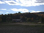
Elias Van Bunschooten House

Historic house museums in New JerseyHouses completed in 1790Houses in Sussex County, New JerseyHouses on the National Register of Historic Places in New JerseyMuseums in Sussex County, New Jersey
National Register of Historic Places in Sussex County, New JerseyNew Jersey Register of Historic PlacesNew Jersey Registered Historic Place stubsUse mdy dates from August 2023Wantage Township, New Jersey
ELIAS VAN BUNSCHOOTEN HOUSE; SUSSEX COUNTY

The Elias Van Bunschooten House is located in Wantage Township, Sussex County, New Jersey, United States. The house was built in 1790 and was added to the National Register of Historic Places on November 1, 1974.

Excerpt from the Wikipedia article Elias Van Bunschooten House (License: CC BY-SA 3.0, Authors, Images).

Elias Van Bunschooten House
NJ 23, Wantage

Geographical coordinates (GPS) Address Nearby Places
placeShow on map

Wikipedia: Elias Van Bunschooten HouseContinue reading on Wikipedia

Geographical coordinates (GPS)

Latitude Longitude
N 41.264166666667 ° E -74.636388888889 °
placeShow on map

Address

NJ 23 1088
07461 Wantage
New Jersey, United States
mapOpen on Google Maps

ELIAS VAN BUNSCHOOTEN HOUSE; SUSSEX COUNTY
Share experience

Nearby Places

Rutan Hill
Rutan Hill

Rutan Hill (also called Volcanic Hill) is the local name for a hill on the United States Geological Survey Branchville 7.5-minute map. It is located about 2.46 miles (3.96 km) south-southwest of Colesville, New Jersey in Wantage Township, of Sussex County, New Jersey in the United States. Rutan Hill rises about 270 feet (82 m) above the adjacent creek valley to an elevation of just over 1,020 feet (310 m). This hill lies entirely within private, posted property. This nondescript hill is the surface expression of a diatreme that is the northern part of the Late Ordovician Beemerville Alkaline Complex.The surface exposures of the Beemerville Alkaline Complex consist of two large nepheline syenite plutons; a nearby diatreme (Rutan Hill); and several other nearby and much smaller dikes, sills, and diatremes. The two large nepheline syenite plutons are located south-southwest of Rutan Hill along the contact between the Martinsburg and Shawangunk formations and on the southeast side of Kittatinny Mountains. The dikes or sills consist either of phonolite, tinguaite, lamprophyre micromalignite, lamprophyre micromelteigite, or carbonatite. The Beemerville Alkaline Complex also includes several lamprophyric diatremes that contain xenoliths of sedimentary rocks and gneiss and autoliths of carbonatite, potassic syenite, and lamprophyre micromelteigite.Rutan Hill is the surface expression of the largest of the lamprophyric diatremes within the Beemerville Alkaline Complex. This diatreme contains a small plug-like body of nepheline syenite that is about 30 meters (98 ft) in diameter and is choked with variety of angular to subangular xenoliths and autoliths. The xenoliths consist of shale and graywacke, fine-grained pale-blue dolomite, cream-colored fine-grained limestone, and gneiss. The autoliths consist of nepheline syenite, micromelteigite, and carbonatite. The matrix consists of an extremely fine-grained groundmass with fine-to coarse-grained megacrysts of biotite, diopside, aegerine-augite, orthoclase, magnetite, apatite, and nepheline.Rutan Hill and the associated Beemerville Alkaline Complex are the surface exposures of a much larger alkaline igneous intrusion that underlies the area of Beemerville, New Jersey. This igneous intrusion is part of the larger Cortlandt-Beemerville magmatic belt. They occur at the western end of the Cortlandt-Beemerville magmatic belt, which spans parts of northern New Jersey and southeastern New York. The Cortlandt complex, New York, defines the eastern end of this belt. Between the Beemerville alkaline complex and the Cortlandt igneous complex, this magmatic belt consists of a linear, almost east–west trending, zone of lamprophyre and felsic dikes.The currently accepted age for the emplacement Beemerville Alkaline Complex is 420 ± 6 Ma. This age is derived by the fission track dating of titanite. Mean apatite fission-track age of 156 ± 4 Ma is interpreted to represent the time the rocks of the complex were last at temperatures of 60 °C to 100 °C. Previously, Rb-Sr and K–Ar dating of biotite from the nepheline syenite at Beemerville yielded ages of about 435 ± 20 Ma (444 Ma. using current decay constants) for the Beemerville Alkaline Complex. All of these dates are consistent with the observations that the dikes of the Beemerville Alkaline Complex crosscut folded and foliated strata of the Martinsburg Formation as young as early Late Ordovician but are not known to intrude younger rocks.Based upon emplacement models for diatremes it can be inferred that the diatreme that forms Rutan Hill is the throat of an ancient, extinct volcano. However, erosion following its eruption has either completely destroyed the volcanic cone and any superficial volcanic deposits associated with it or any remaining volcanic deposits lie deeply buried as none have been mapped at the surface within the Beemerville area.This igneous complex was emplaced and the volcanic activity, which was presumably associated with it, occurred during the end of the Taconic Orogeny in the late Ordovician period. The temporal association with this Ordovician tectonism suggests that this magmatic activity may be related to fracturing of mantle rock at the junction of two Taconic age tectonic salients that intersect in the New York region. The tectonic setting of the intrusive belt is unusual because it is associated in space and time within the zone of compressional mountain building that defined the Taconic Orogeny. At that time, the western half of the Iapetus Ocean lying along the east coast of Laurentia was closing, being subducted beneath the Taconic (or Bronson Hill) Island Arc.

High Point State Park

High Point State Park is a state park straddling the border of Wantage Township and Montague Township in Sussex County, within the Skylands Region of northwestern New Jersey, United States, near the border with New York State and Pennsylvania. The park covers 15,413 acres (62.37 km2). Part of the Kittatinny Mountains, the highest point in the state of New Jersey, the aptly named High Point, sits in the northern reaches of the park, at elevation 1,803 feet (550 m). Route 23 skirts the park and provides access for visitors from the New Jersey suburbs and from points in New York. The park is administered by the New Jersey Division of Parks and Forestry. Entrance fees are only charged from Memorial Day weekend to Labor Day: $5.00 on weekdays and $10.00 on weekends.High Point Monument, built at the summit, offers views of farmland and forest, hills and valleys in three states, out to the Delaware Water Gap National Recreation Area, where the Delaware River separates the ridges of New Jersey from those of Pennsylvania. High Point offers trails for hiking and cross-country skiing and areas for camping and fishing. The land for High Point State Park, donated by Colonel Anthony R. and Susie Dryden Kuser, was dedicated as a park in 1923. The pleasant landscaping was designed by the Olmsted Brothers of Boston, a prominent landscape architectural firm of that time. The brothers were the sons of Frederick Law Olmsted, who designed Central Park.To the south, the Appalachian Trail follows a rocky ridge which has views of the valleys and mountains surrounding the area. To the north, the trail drops off the ridge through hemlock gorges into former agricultural fields with a view of the surrounding countryside and the High Point Monument in the distance.

New Jersey's 5th congressional district

New Jersey's 5th congressional district is represented by Democrat Josh Gottheimer, who has served in Congress since 2017. The district stretches across the entire northern border of the state and contains most of Bergen County, as well as parts of Passaic County and Sussex County. Historically, most of the areas in the district have generally been favorable for Republicans. This is especially true of the western portion, which contains some of the most Republican areas in the Northeast. However, Bergen County has trended Democratic in recent elections, though not as overwhelmingly as in the more urbanized southern portion of Bergen County, this latter portion being in the ninth congressional district. Partly due to a strong performance in Bergen County, Josh Gottheimer unseated 14-year Republican incumbent Scott Garrett in 2016. This made Garrett the only one of the state's 12 incumbents to lose reelection that year and marked the first time a Democrat won this seat since 1930.Since redistricting in the early 1990s, this congressional district has been L-shaped, comprising the rural northern and western parts of New Jersey along with parts of Passaic and Bergen County. After redistricting in late 2021, which was based on the 2020 census, the 5th lost all of its towns in Warren County. It also contains less of Sussex County and includes more of eastern Bergen County than was the case during the 2010s, making the district somewhat more Democratic.