Gettys-Black divide

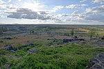
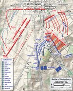
The Gettys-Black divide is the primary drainage divide of Cumberland Township, Adams County, Pennsylvania; extending from the mouth of Stevens Creek southward past Samuel Gettys' 1761 tavern ~7 miles to the mouth of Plum Run at the dam site for Robert Black's 1798 Mill. From a ridge within the Gettysburg borough, the divide extends southward across several strategic features of the Gettysburg Battlefield: Cemetery Hill (503 ft) Cemetery Ridge, including the triple point for Plum R/Stevens Cr (west) & Rock Cr (east) Weikert Hill Little Round Top Big Round TopThe divide descends the east slope of Big Round Top and passes north of a drainage, then extends south-southeast across farm fields near the Taneytown Road to Rock Creek at the unincorporated community of Barlow, Pennsylvania.
Excerpt from the Wikipedia article Gettys-Black divide (License: CC BY-SA 3.0, Authors, Images).Gettys-Black divide
Old Harrisburg Road,
Geographical coordinates (GPS) Address Nearby Places Show on map
Geographical coordinates (GPS)
| Latitude | Longitude |
|---|---|
| N 39.836880555556 ° | E -77.221527777778 ° |
Address
Harrisburg Area Community College Gettysburg Campus
Old Harrisburg Road 731
17325
Pennsylvania, United States
Open on Google Maps


