place

Jessie Eyman–Wilma Judson House

American Craftsman architecture in HawaiiHistory of OahuHouses in Honolulu County, HawaiiHouses on the National Register of Historic Places in HawaiiNational Register of Historic Places in Honolulu County, Hawaii
Honolulu PatyDr3114 frontwide

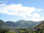
The Jessie Eyman–Wilma Judson House at 3114 Paty Drive in Honolulu, Hawaiʻi, was one of the earliest residences designed by C.W. Dickey in his "Hawaiian style" after he finally returned to the islands for good in 1925. It was built in 1926 for Jessie Eyman and Wilma Judson, two nurses who arrived from Illinois in 1925. The house was added to the National Register of Historic Places in 1986.The house sits on a sharply triangular hillside lot overlooking Manoa Valley at the intersection of Alani Drive (below) and Paty Drive (above, formerly Dillingham Drive). Its "Hawaiian style" architecture includes Dickey's trademark double-pitched hip roof with overhanging eaves, ample windows, and an enclosed lanai at the south-facing entrance. The single-story house, one-room deep, with board-and-batten siding, wraps around an open courtyard in the rear. One wing off the living room contains two bedrooms and a bath. The dining room and kitchen occupy the right rear wing, near a maid's quarters and a garage on the south side.The original owners lived in the house until 1940, when Judson sold her share to Eyman, who sold the house in 1943. As nurses, they set up the first Physicians Telephone Exchange in the Territory. Judson also worked many years for Dr. Forrest Joy Pinkerton, who founded the Blood Bank of Hawaiʻi and the Pan-Pacific Surgical Association. Eyman managed the Mabel Smyth Memorial Building from the time it was built in 1941 until she retired in 1952.

Excerpt from the Wikipedia article Jessie Eyman–Wilma Judson House (License: CC BY-SA 3.0, Authors, Images).

Jessie Eyman–Wilma Judson House
Kolomona Place, East Honolulu Mānoa

Geographical coordinates (GPS) Address Nearby Places
placeShow on map

Wikipedia: Jessie Eyman–Wilma Judson HouseContinue reading on Wikipedia

Geographical coordinates (GPS)

Latitude Longitude
N 21.314722222222 ° E -157.80333333333 °
placeShow on map

Address

Kolomona Place 2999
96822 East Honolulu, Mānoa
Hawaii, United States
mapOpen on Google Maps

Honolulu PatyDr3114 frontwide
Share experience

Nearby Places

Republic of Hawaii
Republic of Hawaii

The Republic of Hawaii (Hawaiian: Lepupalika o Hawaiʻi) was a short-lived one-party state in Hawaiʻi between July 4, 1894, when the Provisional Government of Hawaii had ended, and August 12, 1898, when it became annexed by the United States as an organized incorporated territory of the United States. In 1893 the Committee of Public Safety overthrew Kingdom of Hawaii Queen Liliʻuokalani after she rejected the 1887 Bayonet Constitution. The Committee of Public Safety intended for Hawaii to be annexed by the United States but President Grover Cleveland, a Democrat opposed to imperialism, refused. A new constitution was subsequently written while Hawaii was being prepared for annexation. The leaders of the Republic such as Sanford B. Dole and Lorrin A. Thurston were Hawaii-born descendants of American settlers who spoke the Hawaiian language but had strong financial, political, and family ties to the United States. They intended the Republic to become a territory of the United States. Dole was a former member of the Royal Legislature from Koloa, Kauai, and Justice of the Kingdom's Supreme Court, and he appointed Thurston—who had served as Minister of Interior under King Kalākaua—to lead a lobbying effort in Washington, D.C. to secure Hawaii's annexation by the United States. The issue of overseas imperialism was controversial in the United States due to its colonial origins. Hawaii was annexed under Republican President William McKinley on 12 August 1898, during the Spanish–American War. The Territory of Hawaii was formally established as part of the U.S. on June 14, 1900. The Blount Report "first provided evidence that officially identified the United States' complicity in the lawless overthrow of the lawful, peaceful government of Hawaii." American officials immediately recognized the new government and U.S. Marines were sent by the US Minister to aid in the overthrow. The Queen's supporters charged the Marines' presence frightened the Queen and thus enabled the revolution. Blount concluded that the United States had carried out unauthorized partisan activities, including the landing of U.S. Marines under a false or exaggerated pretext, to support the anti-royalist conspirators; that these actions were instrumental to the success of the revolution; and that the revolution was carried out against the wishes of a majority of the population of Hawaii.

Territory of Hawaii
Territory of Hawaii

The Territory of Hawaii or Hawaii Territory (Hawaiian: Panalāʻau o Hawaiʻi) was an organized incorporated territory of the United States that existed from April 30, 1900, until August 21, 1959, when most of its territory, excluding Palmyra Island, was admitted to the United States as the 50th U.S. state, the State of Hawaii. The Hawaii Admission Act specified that the State of Hawaii would not include Palmyra Island, the Midway Islands, Kingman Reef, and Johnston Atoll, which includes Johnston (or Kalama) Island and Sand Island.On July 4, 1898, the United States Congress passed the Newlands Resolution authorizing the U.S. annexation of the Republic of Hawaii, and five weeks later, on August 12, Hawaii became a U.S. territory. In April 1900 Congress approved the Hawaiian Organic Act which organized the territory. United States Public Law 103-150 adopted in 1993, (informally known as the Apology Resolution), acknowledged that "the overthrow of the Kingdom of Hawaii occurred with the active participation of agents and citizens of the United States" and also "that the Native Hawaiian people never directly relinquished to the United States their claims to their inherent sovereignty as a people over their national lands, either through the Kingdom of Hawaii or through a plebiscite or referendum".Hawaii's territorial history includes a period from 1941 to 1944, during World War II, when the islands were placed under martial law. Civilian government was dissolved and a military governor was appointed.

Dr. Archibald Neil Sinclair House

The Dr. Archibald Neil Sinclair House on Puʻu Pueo ('Owl Hill') overlooking Mānoa Valley and Diamond Head on the island of Oʻahu was built in 1917 in a Colonial Revival style designed by a leading local architectural firms, Emory and Webb, who also designed the Hawaii Theatre and other fine buildings on the island. The large, sloping property has two entrances: one below the front lawn at 2726 Hillside Ave., the other above the house at 2725 Terrace Dr., Honolulu, Hawaiʻi. It was listed in the National Register of Historic Places in 1983.The two-story, wood frame, 2,811 sq. ft. main house is a fine example of the Colonial Revival style as adapted to Hawaiʻi, with extensive verandahs and balconies outside and open spaces inside delineated by columns rather than walls. Its foundation rests on lava rock and redwood piles. There is a separate, 240 sq. ft. maid's quarters and garage accessible from Terrace Drive and an underground bomb shelter (added later) below the front lawn.Dr. Sinclair (b. 20 January 1871) was a prominent physician whose father had come to Honolulu from New York to supervise the construction of ʻIolani Palace. He attended Punahou School then obtained a medical degree from the University of Glasgow in Scotland in 1894. He began his medical practice in England before returning to Honolulu, where he served with the United States Public Health Service (1900–1919), as city physician (1901–1909), and as founding director of Leahi Home for tuberculosis patients (1901). His published research in the fields of bacteriology, immunology, and pulmonary diseases earned him induction into the American College of Physicians and other medical societies. The Sinclair Society of pulmonary specialists is named for him.The house was built in the College Hills tract (named for Oahu College, now Punahou School), a rapidly expanding suburb of Honolulu that was newly served by the extension of electric streetcar lines into Mānoa in 1901 and the relocation of the College of Hawaii to Mānoa in 1912. Many later residents of the house have been students and faculty of the University, the most notable being Janet Bell, who served as curator of the Hawaiian Collection from 1936 until 1970.