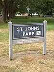
St. Johns, Portland, Oregon
1865 establishments in Oregon1915 disestablishments in OregonFormer cities in OregonNeighborhoods in Portland, OregonPopulated places established in 1865 ... and 1 more
St. Johns, Portland, Oregon

St. Johns is a neighborhood of Portland, Oregon, United States, located in North Portland on the tip of the peninsula formed by the confluence of the Willamette River and the Columbia River. It was a separate, incorporated city from 1902 until 1915, when citizens of both St. Johns and Portland voted to approve its annexation to Portland, which took effect on July 8, 1915.St. Johns is bordered by the Columbia River to the northeast, the Willamette River to the northwest, the North Portland railroad cut to the southeast, and a number of streets separating it from Cathedral Park to the southwest, primarily North Ivanhoe Street.
Excerpt from the Wikipedia article St. Johns, Portland, Oregon (License: CC BY-SA 3.0, Authors, Images).St. Johns, Portland, Oregon
North Columbia Boulevard, Portland Saint Johns
Geographical coordinates (GPS) Address Nearby Places Show on map
Geographical coordinates (GPS)
| Latitude | Longitude |
|---|---|
| N 45.61259 ° | E -122.76287 ° |
Address
North Lombard & Burgard
North Columbia Boulevard
97203 Portland, Saint Johns
Oregon, United States
Open on Google Maps


