Bash Bish Falls State Park

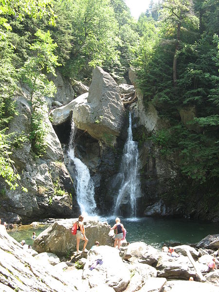
Bash Bish Falls State Park is a Massachusetts state park located in the town of Mount Washington. The park is named after Bash Bish Falls, Massachusetts' highest single-drop waterfall (60 feet (18 m)), which lies within its borders. The park is managed by the Department of Conservation and Recreation and is one of several nature preserves in the extreme southwestern corner of Massachusetts noted for their scenery. It is adjacent to the 4,000-acre (1,600 ha) Mount Washington State Forest, as well as New York's 5,000-acre (2,000 ha) Taconic State Park.Bash Bish State Park consists of numerous gorges and an eastern hemlock ravine forest. The slopes around the waterfall are covered by forests of trees such as maple, oak, and beech. Wildlife includes the timber rattlesnake, the peregrine falcon, bobcats, black bears, and porcupines.
Excerpt from the Wikipedia article Bash Bish Falls State Park (License: CC BY-SA 3.0, Authors, Images).Bash Bish Falls State Park
West Street,
Geographical coordinates (GPS) Address Website External links Nearby Places Show on map
Geographical coordinates (GPS)
| Latitude | Longitude |
|---|---|
| N 42.114722222222 ° | E -73.492777777778 ° |
Address
Bash Bish Falls State Park
West Street
12517
Massachusetts, United States
Open on Google Maps


