Ballakilpheric
Villages in the Isle of Man

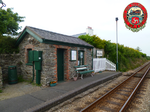
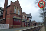
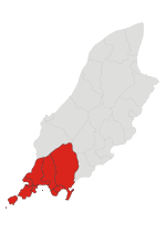
Ballakilpheric (Manx: Balley Keeill Pherick; meaning "settlement of St Patrick's church") is a small village in the parish of Rushen (recently amalgamated with Arbory for administrative purposes) in the southwest of the Isle of Man, 1 kilometre (0.6 mi) northwest of the larger village of Colby, and 8 kilometres (5 mi) by road northeast of Port Erin. It is the main settlement on the B44 road. The small Colby River flows to the east of the village, and forms the boundary with Arbory parish. Ballakilpheric Methodist Chapel lies at the top of the hill.
Excerpt from the Wikipedia article Ballakilpheric (License: CC BY-SA 3.0, Authors, Images).Ballakilpheric
Ballakilpheric Road,
Geographical coordinates (GPS) Address Nearby Places Show on map
 Continue reading on Wikipedia
 Geographical coordinates (GPS)
| Latitude | Longitude |
|---|---|
| N 54.107222222222 ° | E -4.7169444444444 ° |
Address
Ballakilpheric Road
Ballakilpheric Road
IM9 4BS
Isle of Man
Open on Google Maps