Port St Mary
Ports and harbours of the Isle of ManUse British English from May 2017Villages in the Isle of Man

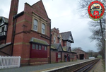
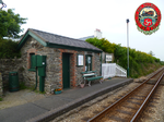
Port St Mary (Manx: Purt le Moirrey or Purt-noo-Moirrey) is a village district in the south-west of the Isle of Man. The village takes its name from the former Chapel of St Mary (Manx: Keeill Moirrey) which is thought to have overlooked Chapel Bay in the village. Its population is 1,953 according to the 2011 census. In the 19th century it was sometimes called Port-le-Murray.
Excerpt from the Wikipedia article Port St Mary (License: CC BY-SA 3.0, Authors, Images).Port St Mary
Lhargan,
Geographical coordinates (GPS) Address Nearby Places Show on map
 Continue reading on Wikipedia
 Geographical coordinates (GPS)
| Latitude | Longitude |
|---|---|
| N 54.0749 ° | E -4.7389 ° |
Address
Lhargan
Lhargan
Isle of Man
Open on Google Maps