place

Malvern water

Bottled water brandsCommons category link is locally definedEnglish brandsEnglish drinksMalvern, Worcestershire
Non-alcoholic drinksSprings of EnglandUse British English from December 2011Water
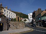
St. Anne's Well by Jim Linwood

Malvern water is a natural spring water from the Malvern Hills on the border of the counties of Herefordshire and Worcestershire in England. The Hills consist of very hard granite and limestone rock. Fissures in the rock retain rain water, which slowly permeates through, escaping at the springs. The springs release an average of about 60 litres a minute and the flow has never been known to cease. Beneficial properties of the water have been reported for over 400 years, and the reason for such benefits was a topic of scholarly discussion by 1817. In the 19th century Malvern became famous for the water cure, resulting in its rapid development from a village to a busy town with many large Victorian and Edwardian hotels. The writings of the hydrotherapists James Gully and James Wilson, and well known patients who included Lord Lytton contributed to Malvern's renown at that time. The water was bottled on an industrial scale under the Schweppes brand from 1850 until 2010, and has been bottled by a family-owned company since 2009 as Holywell Malvern Spring Water. In 2012 the Holywell Water Co Ltd was granted permission to use the world-famous "Malvern" name in its branding, thus becoming Holywell Malvern Spring Water. It has been drunk by several British monarchs. Elizabeth I drank it in public in the 16th century; Queen Victoria refused to travel without it.

Excerpt from the Wikipedia article Malvern water (License: CC BY-SA 3.0, Authors, Images).

Malvern water
West Malvern Road, Malvern Hills

Geographical coordinates (GPS) Address Nearby Places
placeShow on map

Wikipedia: Malvern waterContinue reading on Wikipedia

Geographical coordinates (GPS)

Latitude Longitude
N 52.098913 ° E -2.337341 °
placeShow on map

Address

West Malvern Road
WR14 4NN Malvern Hills
England, United Kingdom
mapOpen on Google Maps

St. Anne's Well by Jim Linwood
Share experience

Nearby Places

Wyche, Worcestershire

Wyche ( WITCH), often referred to locally as The Wyche, is a village and a suburb of the town of Malvern, Worcestershire, England, and part of the civil parish of Malvern Wells. It is situated approximately 1 mile (1.6 km) south of Great Malvern, the town's centre, on the B4218 road that runs from Malvern to Colwall. The western boundary of the village is marked by The Wyche Cutting, a pass through the Malvern Hills that was once part of an Iron Age salt route, hence the name "Wyche" — several places in England associated with salt have this (or similar) in their name. As the crest of the Malvern Hills (running north to south) defines this part of the border between the two counties of Herefordshire and Worcestershire, The Wyche Cutting itself forms a narrow pass through the hills between the counties. From the 1920s until the 1960s, this road (passing through The Wyche Cutting and Colwall) was the A4105, before being re-classified as the B4218. The Wyche village comprises the two informal areas of Upper Wyche and Lower Wyche, mainly comprising residential properties. The Wyche Inn is a public house situated in Upper Wyche and is the county's highest pub, with views to the east overlooking the Severn valley. Old Wyche Road is one of the country's steepest streets, with an incline as great as 17.54° at Upper Wyche.Just on the Herefordshire side of the Cutting (in Upper Colwall) is the location of the Wyche Innovation Centre, that was the former Skot Transformers building. This is also the home of the Malvern Hills Geocentre, a visitor centre based entirely on iPads with an attached cafe. Also in Upper Colwall is the Wyche Free Church.The nearest railway stations are Great Malvern (for the lower end) and Colwall (for the upper end); both are on the same line. The Wyche CE Primary School is located in Lower Wyche.