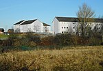
Hurlet
Areas of GlasgowGlasgow geography stubsUse British English from May 2015

Hurlet (or The Hurlet) is a small semi-rural district and former mining village, straddling the Renfrewshire-East Renfrewshire-Glasgow border near the town of Barrhead in the lowlands of Scotland. During the late twentieth century, most of the Hurlet was consigned to the history books when the Paisley-East Kilbride road, which cut through the village, was widened to become a dual carriageway. Roughmussel is to the northeast of The Hurlet. Househill Park is to the east, through which the Levern Water flows. The southwest of The Hurlet is St. Conval's Cemetery in Barrhead. Sir Isaac Holden, 1st Baronet was born here in 1807.
Excerpt from the Wikipedia article Hurlet (License: CC BY-SA 3.0, Authors, Images).Hurlet
Hurlet Road, Glasgow Hurlet
Geographical coordinates (GPS) Address Nearby Places Show on map
Geographical coordinates (GPS)
| Latitude | Longitude |
|---|---|
| N 55.819347 ° | E -4.371742 ° |
Address
Hurlet Road
Hurlet Road
G53 7TN Glasgow, Hurlet
Scotland, United Kingdom
Open on Google Maps


