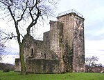
Rosshall
Areas of GlasgowParks and commons in GlasgowUse British English from September 2019

Rosshall is an area in the south-west of Glasgow, Scotland, within the Cardonald ward of Glasgow City Council. It has a fairly isolated location, with the White Cart Water forming a border to the south and east, the Paisley Canal Line railway to the north, and open fields to the west that form a short green belt between Glasgow and the large town of Paisley – the nearest building 500 yards (460 m) to the west, Rosshall Mains Farm, falls under Paisley administration rather than Glasgow.
Excerpt from the Wikipedia article Rosshall (License: CC BY-SA 3.0, Authors, Images).Rosshall
Crookston Road, Glasgow Crookston
Geographical coordinates (GPS) Address Nearby Places Show on map
Geographical coordinates (GPS)
| Latitude | Longitude |
|---|---|
| N 55.839888 ° | E -4.365439 ° |
Address
The Gables
Crookston Road
G52 3NF Glasgow, Crookston
Scotland, United Kingdom
Open on Google Maps


