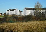
Parkhouse, Glasgow G53

Parkhouse is a residential neighbourhood of Glasgow, Scotland close to the border with East Renfrewshire. It is located on the south-western edge of the city, close to the towns of Barrhead and Newton Mearns in East Renfrewshire. Within the G53 postcode area and the Greater Pollok ward of the Glasgow City Council administration, the eastern cluster of private housing was constructed in the 1980s (branching off Craigflower Road) and the western part in the 2010s, prior to which it was open farmland annexed to Glasgow in 1938.It is one of two places in Glasgow called Parkhouse, the other being an older housing development near Milton in the far north of the city. However, they are rarely confused as neither is particularly well known outside local circles, and wider discussions of issues affecting the neighbourhoods take place under the names of their wider wards or constituencies.
Excerpt from the Wikipedia article Parkhouse, Glasgow G53 (License: CC BY-SA 3.0, Authors, Images).Parkhouse, Glasgow G53
Parkholm Drive, Glasgow Parkhouse
Geographical coordinates (GPS) Address Nearby Places Show on map
Geographical coordinates (GPS)
| Latitude | Longitude |
|---|---|
| N 55.804685 ° | E -4.358321 ° |
Address
Parkholm Drive
Parkholm Drive
Glasgow, Parkhouse
Scotland, United Kingdom
Open on Google Maps


