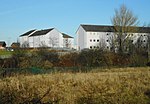
South Nitshill

South Nitshill (Scottish Gaelic: Cnoc nan Cnòthan a Deas) is a neighbourhood in the Scottish city of Glasgow. It is situated south of the River Clyde, in the south-west of the conurbation and within the Greater Pollok ward of the local authority area. All streets in the area have names beginning with 'W'. It is bordered on three sides by other residential areas within Glasgow: to the south by Parkhouse and Southpark Village, to the north-east by Darnley and to the north (across a railway line) by Nitshill, an older settlement which was also developed for housing in the late 1950s. To the west are fields and the Levern Water separating the city from the town of Barrhead in East Renfrewshire. The closest railway station is Nitshill.
Excerpt from the Wikipedia article South Nitshill (License: CC BY-SA 3.0, Authors, Images).South Nitshill
Willowford Road, Glasgow South Nitshill
Geographical coordinates (GPS) Address Nearby Places Show on map
Geographical coordinates (GPS)
| Latitude | Longitude |
|---|---|
| N 55.809286 ° | E -4.360761 ° |
Address
Willowford Road
Willowford Road
G53 7LP Glasgow, South Nitshill
Scotland, United Kingdom
Open on Google Maps


