Possilpark

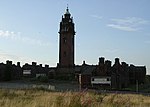
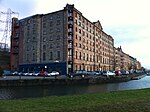
Possilpark is a district in the Scottish city of Glasgow, situated north of the River Clyde and centred around Saracen Street. The area developed around Saracen Foundry of Walter MacFarlane & Co., which was the main employer. In the wake of the Saracen Foundry's closure in 1967, this part of Glasgow became one of the poorest in the United Kingdom, and decades later deprivation and crime rates remain high. A variety of diverse community organisations operate in the area, providing arts, sports, health and gardening provision and community regeneration, including Young People's Futures, The Concrete Garden, Possobilities and Friends of Possilpark Greenspace. The district is served by both Possilpark & Parkhouse and Ashfield railway stations on the Maryhill Line.
Excerpt from the Wikipedia article Possilpark (License: CC BY-SA 3.0, Authors, Images).Possilpark
Mansion Street, Glasgow Possilpark
Geographical coordinates (GPS) Address Nearby Places Show on map
Geographical coordinates (GPS)
| Latitude | Longitude |
|---|---|
| N 55.885397 ° | E -4.25264 ° |
Address
Mansion Street
G22 5LL Glasgow, Possilpark
Scotland, United Kingdom
Open on Google Maps


