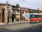
Junction Triangle

Junction Triangle is a neighbourhood in Toronto, Ontario, Canada. It is located in the city's west end, just west of Lansdowne Avenue. The area is a triangle surrounded on all three sides by railway lines: the CNR/CPR mainline to the west, Metrolinx GO Transit Barrie line to the east, and the CPR east-west railway lines to the north. Bloor Street cuts across the middle of the neighbourhood, Dupont Street runs close to the northern edge, and Dundas Street is close to the southern boundary. By some accounts, the recent residential developments of Davenport Village and Foundry Lofts, built on former factory lands north of the CP Rail line, west of Lansdowne, south of Davenport and east of the GO Transit Bradford/Newmarket/Barrie line, also belong in this neighbourhood.
Excerpt from the Wikipedia article Junction Triangle (License: CC BY-SA 3.0, Authors, Images).Junction Triangle
Rankin Crescent, Toronto
Geographical coordinates (GPS) Address Nearby Places Show on map
Geographical coordinates (GPS)
| Latitude | Longitude |
|---|---|
| N 43.659 ° | E -79.446 ° |
Address
Rankin Crescent 78
M6P Toronto
Ontario, Canada
Open on Google Maps


