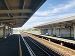
Normans Bay

Normans Bay (Normans' Bay on Ordnance Survey maps) is a coastal fishing hamlet in Bexhill-on-Sea, East Sussex, England. The 8th Duke of Devonshire donated this land for a combined school and place of worship in the 1860s to be known as Pevensey Sluice. It was later renamed Normans Bay when the railway halt of that name was first opened in 1905.Normans Bay is near the popular seaside resorts of Eastbourne and Brighton to the west, with a regular service at Normans Bay railway station. The nearest bus service is in Pevensey Bay. Some points of interest include a sand and shingle beach, Martello tower 55, two caravan sites and a The Star Inn public house. To the north is protected marshland known as Pevensey Levels, and the abandoned medieval village of Northeye.
Excerpt from the Wikipedia article Normans Bay (License: CC BY-SA 3.0, Authors, Images).Normans Bay
Normans Bay Road, Rother Bexhill-on-Sea
Geographical coordinates (GPS) Address Nearby Places Show on map
Geographical coordinates (GPS)
| Latitude | Longitude |
|---|---|
| N 50.8257 ° | E 0.3929 ° |
Address
Normans Bay Road
Normans Bay Road
BN24 6PT Rother, Bexhill-on-Sea
England, United Kingdom
Open on Google Maps


