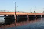
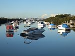
Cooks River
Cooks RiverKyeemagh, New South WalesRivers of Sydney

The Cooks River, a semi-mature tide-dominated drowned valley estuary, is a tributary of Botany Bay, located in south-eastern Sydney, New South Wales, Australia. The course of the 23-kilometre-long (14 mi) urban waterway has been altered to accommodate various developments along its shore. It serves as part of a stormwater system for the 100 square kilometres (39 sq mi) of its watershed, and many of the original streams running into it have been turned into concrete lined channels. The tidal sections support significant areas of mangroves, bird, and fish life, and are used for recreational activities.
Excerpt from the Wikipedia article Cooks River (License: CC BY-SA 3.0, Authors, Images).Cooks River
General Holmes Drive, Sydney Mascot
Geographical coordinates (GPS) Address Nearby Places Show on map
Geographical coordinates (GPS)
| Latitude | Longitude |
|---|---|
| N -33.949166666667 ° | E 151.16833333333 ° |
Address
General Holmes Drive
2020 Sydney, Mascot
New South Wales, Australia
Open on Google Maps


