Weser Uplands-Schaumburg-Hamelin Nature Park
1975 establishments in West GermanyNature parks in Lower SaxonyProtected areas established in 1975

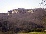
The Weser Uplands-Schaumburg-Hamelin Nature Park (German: Naturpark Weserbergland Schaumburg-Hameln) lies on the northern edge of the German Central Uplands where it transitions to the North German Plain, about 50 kilometres (31 mi) southwest of Hanover. The sponsor of the nature park, which was founded in 1975, is the state of Lower Saxony. The park extends along the Weser valley between Rinteln and Hamelin and includes parts of the Schaumburg Land, Calenberg, Lippe and Pyrmont Uplands from Bad Nenndorf in the north to Bad Pyrmont in the south, Bückeburg and Bad Eilsen in the west and Bad Münder and Osterwald in the east. Its highest elevation is in the Süntel hills.
Excerpt from the Wikipedia article Weser Uplands-Schaumburg-Hamelin Nature Park (License: CC BY-SA 3.0, Authors, Images).Weser Uplands-Schaumburg-Hamelin Nature Park
Werner Speer-Weg,
Geographical coordinates (GPS) Address Nearby Places Show on map
Geographical coordinates (GPS)
| Latitude | Longitude |
|---|---|
| N 52.2033 ° | E 9.3472 ° |
Address
Werner Speer-Weg
Werner Speer-Weg
31848 , Bakede
Lower Saxony, Germany
Open on Google Maps


