Süntel
Central UplandsForests and woodlands of Lower SaxonyHill ranges of Lower Saxony

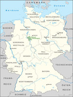
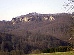
The is a massif in the German Central Uplands that is up to 437.5 m above sea level (NN). It forms part of the Weser Uplands in Lower Saxony southwest of Hanover and north of Hamelin.
Excerpt from the Wikipedia article Süntel (License: CC BY-SA 3.0, Authors, Images).Süntel
Fichtenweg,
Geographical coordinates (GPS) Address Nearby Places Show on map
Geographical coordinates (GPS)
| Latitude | Longitude |
|---|---|
| N 52.2 ° | E 9.35 ° |
Address
Fichtenweg
Fichtenweg
31848
Lower Saxony, Germany
Open on Google Maps


