Mount Rose (New Jersey)
Igneous petrology of New JerseyLandforms of Mercer County, New JerseyMercer County, New Jersey geography stubsRidges of New Jersey
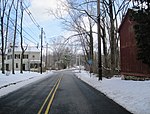
Mount Rose is a narrow section of the Rocky Hill Ridge in Hopewell Township, New Jersey which is 420 feet above sea level. The ridge's western end is at The Sourlands at Hopewell-Pennington Road and its eastern end is near Province Line Road. The ridge is a diabase intrusion and unlike many of the ridges in the state, it runs from northwest to southeast. Crusher Road travels along the ridge. Pennington-Rocky Hill Road, Cherry Valley Road, Hopewell-Princeton Road and Carter Road meet at a low point along the ridge at the village of Mount Rose.
Excerpt from the Wikipedia article Mount Rose (New Jersey) (License: CC BY-SA 3.0, Authors).Mount Rose (New Jersey)
Morris Drive,
Geographical coordinates (GPS) Address Nearby Places Show on map
Geographical coordinates (GPS)
| Latitude | Longitude |
|---|---|
| N 40.360541 ° | E -74.747543 ° |
Address
Morris Drive 34
08540
New Jersey, United States
Open on Google Maps


