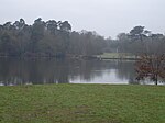
Coxes Lock

Coxes Lock is towards the northern end of the Wey Navigation parallel to the River Wey in Addlestone, Surrey, Most parts of the navigation are canal sections such as this - most only receive flow from opening of locks, small field ditches and rainfall. However a re-engineered brook (the Old Rive Ditch) alongside the Basingstoke Canal at West Byfleet make all sections up to a point near Sheerwater Bridge, Woking receive a light minimum flow. The tallest non-ecclesiastical/civic building in South-East of England outside London pre-dating about 1880 is the east of the former mill blocks, which are now apartments. A tree-lined towpath and lakeside path run to the lock as does a cul-de-sac for vehicles leading to the apartments. The Mill Pond at Coxes Lock is the largest on the Wey Navigation and helps to control the water depth above an engineered rapid 8 feet 6 inches (2.59 m) millstream cascaded drop, which was originally one drop with a turning waterwheel. In some 19th-century sources, Cox's Lock is recorded.
Excerpt from the Wikipedia article Coxes Lock (License: CC BY-SA 3.0, Authors, Images).Coxes Lock
River Wey Navigation path, Borough of Runnymede
Geographical coordinates (GPS) Address Nearby Places Show on map
Geographical coordinates (GPS)
| Latitude | Longitude |
|---|---|
| N 51.366375 ° | E -0.477036 ° |
Address
River Wey Navigation path
River Wey Navigation path
KT15 2JX Borough of Runnymede
England, United Kingdom
Open on Google Maps


