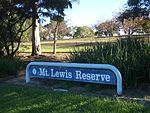
Greenacre, New South Wales
City of Canterbury-BankstownHume HighwayMunicipality of StrathfieldMuslim enclavesSuburbs of Sydney ... and 1 more
Use Australian English from February 2015

Greenacre is a suburb in South-western Sydney, located 20 kilometres south-west of the Sydney central business district in the state of New South Wales, Australia. Most of Greenacre is in the local government area of the City of Canterbury-Bankstown, while a part in the east is in the Municipality of Strathfield.
Excerpt from the Wikipedia article Greenacre, New South Wales (License: CC BY-SA 3.0, Authors, Images).Greenacre, New South Wales
Bromley Avenue, Sydney Greenacre
Geographical coordinates (GPS) Address Nearby Places Show on map
Geographical coordinates (GPS)
| Latitude | Longitude |
|---|---|
| N -33.909166666667 ° | E 151.05333333333 ° |
Address
Bromley Avenue
Bromley Avenue
2190 Sydney, Greenacre
New South Wales, Australia
Open on Google Maps


