Kennebunk, Maine

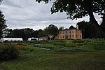
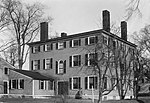
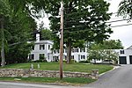
Kennebunk is a town in York County, Maine, United States. The population was 11,536 at the 2020 census. Kennebunk is home to several beaches, the Rachel Carson National Wildlife Refuge, the 1799 Kennebunk Inn, many historic shipbuilders' homes, the Brick Store Museum and the Nature Conservancy Kennebunk Plains (known locally as the Blueberry Plains), with 1,500 acres (6 km2) of nature trails and blueberry fields. The municipality includes the constituent villages of Kennebunk Village (Town), the Lower Village (Lower Kennebunk), Kennebunk Landing (the Landing), Bartlett Mills, West Kennebunk, Kennebunk Beach, Lords Point, Coopers Corner Crossing, Sea Roads Crossing, Webahennet Grove, and Vinegarhill, Cheshire Commons, Kennebunk Meadows, and various newer neighborhoods. It does not include Kennebunkport, which is a separate town.
Excerpt from the Wikipedia article Kennebunk, Maine (License: CC BY-SA 3.0, Authors, Images).Kennebunk, Maine
River Oaks Drive,
Geographical coordinates (GPS) Address Nearby Places Show on map
Geographical coordinates (GPS)
| Latitude | Longitude |
|---|---|
| N 43.385555555556 ° | E -70.546944444444 ° |
Address
River Oaks Drive 8
04043
Maine, United States
Open on Google Maps


