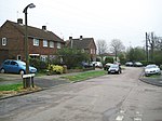
Highfield, Hertfordshire
Areas of Hemel HempsteadHertfordshire geography stubsVillages in Hertfordshire
Highfield is a neighbourhood district in Hemel Hempstead, Hertfordshire, United Kingdom. It was constructed on a green field site as part of the construction of the postwar newtown expansion of Hemel Hempstead. It is located north of the old town centre. It is most likely named from Highfield House which still exists, although ultimately derived from an old field name which reflects the altitude of the district which reaches 469 feet above sea level. At the 2011 census the population of the district was included in the civil parish of Hazlemere
Excerpt from the Wikipedia article Highfield, Hertfordshire (License: CC BY-SA 3.0, Authors).Highfield, Hertfordshire
Malvern Way, Dacorum Highfield
Geographical coordinates (GPS) Address Nearby Places Show on map
Geographical coordinates (GPS)
| Latitude | Longitude |
|---|---|
| N 51.765062 ° | E -0.458135 ° |
Address
Malvern Way
Malvern Way
HP2 5RF Dacorum, Highfield
England, United Kingdom
Open on Google Maps


