Lower Penn
South Staffordshire DistrictStaffordshire geography stubsVillages in Staffordshire
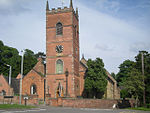
Lower Penn is a village in South Staffordshire, situated to the south-west of Wolverhampton, West Midlands. The Civil Parish covers the area of the historic Parish of Penn that is not now covered by the city of Wolverhampton and thus covers a wider area than that immediately surrounding the village. Part of the parish is considered by the ONS to be part of the Wolverhampton sub-area of the West Midlands conurbation. Lower Penn has a village hall known as Victory Hall, and a pub/restaurant, The Greyhound.
Excerpt from the Wikipedia article Lower Penn (License: CC BY-SA 3.0, Authors).Lower Penn
Springhill Park, South Staffordshire Springhill
Geographical coordinates (GPS) Address Nearby Places Show on map
Geographical coordinates (GPS)
| Latitude | Longitude |
|---|---|
| N 52.5551 ° | E -2.1781 ° |
Address
Springhill Park
Springhill Park
WV4 4TS South Staffordshire, Springhill
England, United Kingdom
Open on Google Maps


