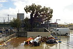
Mount Nasura, Western Australia
Perth, Western Australia geography stubsSuburbs in the City of ArmadaleSuburbs of Perth, Western AustraliaUse Australian English from March 2014
Mount Nasura is a suburb of Perth, Western Australia, located within the City of Armadale. The suburb occupies hilly terrain bounded on the north by Brookton Highway and Hill Street (1.6 km), west by Paterson Road (1.1 km), south-west by Canns and Carradine Roads (1.6 km), south by property boundaries on the north side of the Neerigin Brook (0.3 km), and east by Albany Highway (2.7m). With the exception of the Armadale Kelmscott District Memorial Hospital, the suburb is primarily residential.
Excerpt from the Wikipedia article Mount Nasura, Western Australia (License: CC BY-SA 3.0, Authors).Mount Nasura, Western Australia
Carawatha Avenue, City Of Armadale
Geographical coordinates (GPS) Address Nearby Places Show on map
Geographical coordinates (GPS)
| Latitude | Longitude |
|---|---|
| N -32.138 ° | E 116.026 ° |
Address
Carawatha Avenue
Carawatha Avenue
6112 City Of Armadale, Mount Nasura
Western Australia, Australia
Open on Google Maps


