place

Ebbor Gorge

Canyons and gorges of EnglandMendip HillsNational Trust properties in SomersetNational nature reserves in SomersetSites of Special Scientific Interest in Somerset
Sites of Special Scientific Interest notified in 1952Use British English from July 2014
EbborGorge
EbborGorge

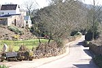
Ebbor Gorge is a limestone gorge in Somerset, England, designated and notified in 1952 as a 63.5-hectare (157-acre) biological Site of Special Scientific Interest in the Mendip Hills. It was donated to the National Trust in 1967 and is now managed by Natural England as a national nature reserve. The gorge was cut mostly into the Clifton Down Limestone, part of the Lower Carboniferous Pembroke Group, by water. The site was occupied by humans in the Neolithic Era and their tools and flint arrow heads have been discovered, along with pottery from the Bronze Age. There are also fossils of small mammals from the Late Devensian. The nature reserve provides a habitat for a variety of flora and fauna, including flowers, butterflies and bats.

Excerpt from the Wikipedia article Ebbor Gorge (License: CC BY-SA 3.0, Authors, Images).

Ebbor Gorge
Deerleap, Mendip St Cuthbert Out

Geographical coordinates (GPS) Address Nearby Places
placeShow on map

Wikipedia: Ebbor GorgeContinue reading on Wikipedia

Geographical coordinates (GPS)

Latitude Longitude
N 51.234 ° E -2.682 °
placeShow on map

Address

Deerleap

Deerleap
BA5 1AY Mendip, St Cuthbert Out
England, United Kingdom
mapOpen on Google Maps

EbborGorge
EbborGorge
Share experience

Nearby Places

Wookey Hole Caves
Wookey Hole Caves

Wookey Hole Caves () are a series of limestone caverns, a show cave and tourist attraction in the village of Wookey Hole on the southern edge of the Mendip Hills near Wells in Somerset, England. The River Axe flows through the cave. It is a Site of Special Scientific Interest (SSSI) for both biological and geological reasons. Wookey Hole cave is a "solutional cave", one that is formed by a process of weathering in which the natural acid in groundwater dissolves the rocks. Some water originates as rain that flows into streams on impervious rocks on the plateau before sinking at the limestone boundary into cave systems such as Swildon's Hole, Eastwater Cavern and St Cuthbert's Swallet; the rest is rain that percolates directly through the limestone. The temperature in the caves is a constant 11 °C (52 °F). The caves have been used by humans for around 45,000 years, demonstrated by the discovery of tools from the Palaeolithic period, along with fossilised animal remains. Evidence of Stone and Iron Age occupation continued into Roman Britain. A corn-grinding mill operated on the resurgent waters of the River Axe as early as the Domesday survey of 1086. The waters of the river are used in a handmade paper mill, the oldest extant in Britain, which began operations circa 1610. The low, constant temperature of the caves means that they can be used for maturing Cheddar cheese. The caves were the site of the first cave dives in Britain, undertaken by Jack Sheppard and Graham Balcombe in the 1930s. Since then, divers have explored the extensive network of chambers developing breathing apparatus and novel techniques in the process. The full extent of the cave system is still unknown with approximately 4,000 metres (13,000 ft), including 25 chambers, having been explored. Part of the cave system opened as a show cave in 1927 following exploratory work by Herbert E. Balch. As a tourist attraction it has been owned by Madame Tussauds and, most recently, the circus owner Gerry Cottle. The cave is notable for the Witch of Wookey Hole, a roughly human-shaped stalagmite that legend says is a witch turned to stone by a monk from Glastonbury. It has also been used as a location for film and television productions, including the Doctor Who serial Revenge of the Cybermen.

Brimble Pit and Cross Swallet Basins

Brimble Pit and Cross Swallet Basins (grid reference ST512505) is a 154.3 hectare (381.3 acre) geological Site of Special Scientific Interest between Wookey Hole and Priddy in the Mendip Hills, Somerset, notified in 1987. The site covers the two adjacent karstic basins draining into Brimble Pit and Cross Swallet. These are the two best defined of the belt of large shallow closed depressions which account for the total Topography along the southern edge of the Mendip Hills. The Brimble Pit depression has a large old lake sediment floor now pitted with sinkholes, while the Cross Swallet Basin feeds to a single active sinkhole around which are well preserved terraces of both rock and sediment. Both depressions have marginal cols feeding to overflow channels now permanently dry. The site also contains important Pleistocene/Quaternary mammal remains within sediments infilling former caverns exposed on the north east face of Westbury Quarry.The swallet was excavated by William Stanton between 1991 & 1992 for spelaeological purposes. However, archaeological material was discovered, leading Stanton to separate the deposits he was removing and examine them for archaeological material, which included 42 sherds of Grooved Ware pottery and a polished greenstone axehead.The area is included in the Cook's Fields Nature Reserve run by the Somerset Wildlife Trust.The Site of Special Scientific Interest is divided into units by Natural England. The Church Commissioners own the land on which part of unit 1 is situated