place

Underwood Quarry

Quarries in the Mendip HillsUse British English from February 2023Wells, Somerset
Underwood Quarry geograph.org.uk 94647

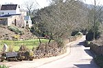
Underwood Quarry is a former quarry near Wells, Somerset on the southern edge of the Mendip Hills that produced Carboniferous Limestone. The rock was described as having very little faulting and a consistent nature, and as being ideal for road making and maintenance.

Excerpt from the Wikipedia article Underwood Quarry (License: CC BY-SA 3.0, Authors, Images).

Underwood Quarry
Lime Kiln Lane, Mendip St Cuthbert Out

Geographical coordinates (GPS) Address Nearby Places
placeShow on map

Wikipedia: Underwood QuarryContinue reading on Wikipedia

Geographical coordinates (GPS)

Latitude Longitude
N 51.2183 ° E -2.6599 °
placeShow on map

Address

Lime Kiln Lane

Lime Kiln Lane
BA5 3AE Mendip, St Cuthbert Out
England, United Kingdom
mapOpen on Google Maps

Underwood Quarry geograph.org.uk 94647
Share experience

Nearby Places

Wells (Tucker Street) railway station

Wells (Tucker Street) railway station was the second terminus station on the Bristol and Exeter Railway's Cheddar Valley line in Somerset after the extension from the first terminus at Cheddar was opened. It was the third station on the third railway to reach the city of Wells and proved to be the longest surviving. The station was opened with the extension of the broad gauge line from Cheddar on 5 April 1870. It was converted to standard gauge in the mid-1870s and then became Wells' main station when the Cheddar Valley line was linked up to the East Somerset Railway to provide through services from Yatton to Witham in 1878. To achieve this through-running, the Great Western Railway, which had by this time taken over both the Bristol and Exeter and the East Somerset lines, had to run trains over rails owned by the separate Somerset and Dorset Joint Railway and through the S&DJR terminus station at Priory Road to the East Somerset station which was across the street. The East Somerset station at this stage closed, but GWR trains ran through Priory Road without stopping for a further 56 years, until in 1934 they started to call at the S&D station. Priory Road closed in 1951 with the closure of the S&D branch line from Glastonbury and Street, leaving Tucker Street as the only station in Wells. In fact, as the "main" station on the most direct line from other centres of population, Tucker Street station was known simply as "Wells" for the first 50 years of its life, being renamed only on 12 July 1920. It resumed the Wells name on 29 October 1951 when Priory Road shut. But Tucker Street station lasted only a dozen years longer. The Yatton to Witham line closed to passengers on 9 September 1963, though goods traffic mostly carrying stone passed through from Cheddar until 1969. The station was demolished soon after closure but the goods shed remains as commercial premises and a row of five houses built for the staff are still standing.

Wells (Priory Road) railway station

Wells (Priory Road) was a railway station on the Somerset and Dorset Joint Railway at Wells in the county of Somerset in England. Opening on 15 March 1859 as Wells, on the Somerset Central Railway, at that time a broad-gauge line operated by the Bristol and Exeter Railway, prior to that company's amalgamation with the Dorset Central Railway to form the Somerset & Dorset, it was the terminus of the branch from Glastonbury. The East Somerset Railway, an offshoot of the Great Western Railway-owned Wilts, Somerset and Weymouth Railway, extended its line to Wells in 1862 with its own station to the east of Priory Road. Then in 1870, the Bristol and Exeter Railway's Cheddar Valley Railway from Yatton reached Wells with a third terminus station at Tucker Street to the north west of Priory Road. Finally, in 1878, with all three lines by this time converted to standard gauge, the GWR linked the Cheddar Valley line to the East Somerset line by running over a stretch of the Somerset and Dorset line, including through Priory Road station. The East Somerset station closed on the commencement of through-running, but the through trains did not stop at Priory Road until 1934 and for 56 years passengers from, say, Glastonbury to Cheddar would need to change stations in Wells. Priory Road adopted the full name in October 1883, and the Cheddar Valley line station was renamed as Tucker Street in 1920. Priory Road station consisted of one platform with a station building and an overall roof. The adjacent goods yard and junction with the GWR were controlled from a signal box. The station closed to passengers on 29 October 1951 and the train shed roof was taken down soon after, although passenger traffic on the former GWR line through the station continued until 1963, with goods traffic until 1969. The station was demolished after closure and the site is now occupied by the city centre by-pass road.

Wookey Hole Caves
Wookey Hole Caves

Wookey Hole Caves () are a series of limestone caverns, a show cave and tourist attraction in the village of Wookey Hole on the southern edge of the Mendip Hills near Wells in Somerset, England. The River Axe flows through the cave. It is a Site of Special Scientific Interest (SSSI) for both biological and geological reasons. Wookey Hole cave is a "solutional cave", one that is formed by a process of weathering in which the natural acid in groundwater dissolves the rocks. Some water originates as rain that flows into streams on impervious rocks on the plateau before sinking at the limestone boundary into cave systems such as Swildon's Hole, Eastwater Cavern and St Cuthbert's Swallet; the rest is rain that percolates directly through the limestone. The temperature in the caves is a constant 11 °C (52 °F). The caves have been used by humans for around 45,000 years, demonstrated by the discovery of tools from the Palaeolithic period, along with fossilised animal remains. Evidence of Stone and Iron Age occupation continued into Roman Britain. A corn-grinding mill operated on the resurgent waters of the River Axe as early as the Domesday survey of 1086. The waters of the river are used in a handmade paper mill, the oldest extant in Britain, which began operations circa 1610. The low, constant temperature of the caves means that they can be used for maturing Cheddar cheese. The caves were the site of the first cave dives in Britain, undertaken by Jack Sheppard and Graham Balcombe in the 1930s. Since then, divers have explored the extensive network of chambers developing breathing apparatus and novel techniques in the process. The full extent of the cave system is still unknown with approximately 4,000 metres (13,000 ft), including 25 chambers, having been explored. Part of the cave system opened as a show cave in 1927 following exploratory work by Herbert E. Balch. As a tourist attraction it has been owned by Madame Tussauds and, most recently, the circus owner Gerry Cottle. The cave is notable for the Witch of Wookey Hole, a roughly human-shaped stalagmite that legend says is a witch turned to stone by a monk from Glastonbury. It has also been used as a location for film and television productions, including the Doctor Who serial Revenge of the Cybermen.