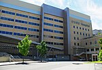
Marquam Hill, Portland, Oregon
Geography of Portland, OregonHills of OregonLandforms of Multnomah County, OregonMultnomah County, Oregon geography stubsOregon Health & Science University ... and 1 more
Southwest Portland, Oregon

Marquam Hill is a populated hill located just south of Downtown Portland, Oregon, United States in the Homestead neighborhood. It is also called Pill Hill because it is home to Oregon Health & Science University, Portland VA Medical Center and Portland Shriners Hospital.Marquam Hill was named for Philip A. Marquam. It is classed by the United States Geological Survey as a populated place and not as a hill. It is part of the Tualatin Mountains, along with nearby Council Crest and Portland Heights.
Excerpt from the Wikipedia article Marquam Hill, Portland, Oregon (License: CC BY-SA 3.0, Authors, Images).Marquam Hill, Portland, Oregon
Southwest 12th Avenue, Portland Homestead
Geographical coordinates (GPS) Address Nearby Places Show on map
Geographical coordinates (GPS)
| Latitude | Longitude |
|---|---|
| N 45.500118 ° | E -122.692318 ° |
Address
Southwest 12th Avenue 3203
97239 Portland, Homestead
Oregon, United States
Open on Google Maps


