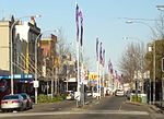
Marrickville Council

Marrickville Council was a local government area located in the Inner West region of Sydney, Australia. It was originally created on 1 November 1861 as the "Municipality of Marrickville". On 12 May 2016, Marrickville Council was forcibly merged with Ashfield and Leichhardt councils into the newly formed Inner West Council.The area was bounded by Leichhardt to the north, the City of Sydney to the east and north-east, the City of Botany Bay to the south-east, Rockdale to the south, Canterbury to the west, and Ashfield to the north-west. It covers an area of approximately 17 square kilometres (6.6 sq mi). The area is roughly bounded by Parramatta Road to the north, King Street and the Princes Highway to the east, the Cooks River and Alexandra Canal to the south, and New and Old Canterbury Roads to the west. While the area's background was traditionally working-class, which made the area a stronghold for the Australian Labor Party, several waves of immigration and a continuing trend of gentrification substantially influenced the demographics and character of the area, increasing the number of independents and Greens on the Council. The last Mayor of Marrickville Council was Cr. Sam Iskandar of the Labor Party. In December 2021, a majority of voters in Inner West Council voted in favour of reversing the 2016 merger and separating the three pre-existing councils of Ashfield, Leichhardt and Marrickville.
Excerpt from the Wikipedia article Marrickville Council (License: CC BY-SA 3.0, Authors, Images).Marrickville Council
Jarvie Avenue, Sydney Petersham
Geographical coordinates (GPS) Address Nearby Places Show on map
Geographical coordinates (GPS)
| Latitude | Longitude |
|---|---|
| N -33.9 ° | E 151.15 ° |
Address
Jarvie Avenue
Jarvie Avenue
2049 Sydney, Petersham
New South Wales, Australia
Open on Google Maps

