Antietam National Battlefield
1890 establishments in MarylandAmerican Civil War military monuments and memorialsAmerican Civil War museums in MarylandAmerican Civil War on the National Register of Historic PlacesBattle of Antietam ... and 14 more
Battlefields of the Eastern Theater of the American Civil WarConflict sites on the National Register of Historic Places in MarylandHistoric American Buildings Survey in MarylandHistoric American Landscapes Survey in MarylandHistoric districts on the National Register of Historic Places in MarylandJourney Through Hallowed Ground National Heritage AreaMuseums in Washington County, MarylandNRHP infobox with nocatNational Battlefields and Military Parks of the United StatesNational Park Service areas in MarylandNational Register of Historic Places in Washington County, MarylandParks in Washington County, MarylandSharpsburg, MarylandUse mdy dates from December 2019

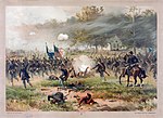
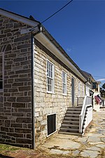
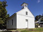
Antietam National Battlefield is a National Park Service-protected area along Antietam Creek in Sharpsburg, Washington County, northwestern Maryland. It commemorates the American Civil War Battle of Antietam that occurred on September 17, 1862. The area, situated on fields among the Appalachian foothills near the Potomac River, features the battlefield site and visitor center, a national military cemetery, stone arch Burnside's Bridge, and a field hospital museum.
Excerpt from the Wikipedia article Antietam National Battlefield (License: CC BY-SA 3.0, Authors, Images).Antietam National Battlefield
Bloody Lane,
Geographical coordinates (GPS) Address Nearby Places Show on map
Geographical coordinates (GPS)
| Latitude | Longitude |
|---|---|
| N 39.470277777778 ° | E -77.738055555556 ° |
Address
Bloody Lane
Bloody Lane
Maryland, United States
Open on Google Maps


