Wemmershoek Dam
Dams completed in 1957Dams in South Africa

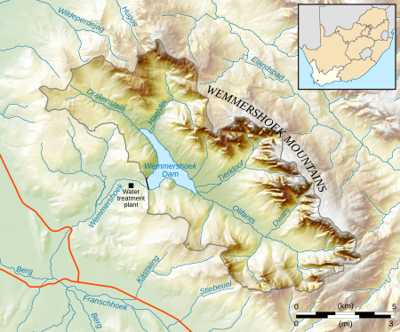
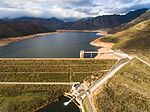
Wemmershoek Dam is a rock-fill type dam located on the Wemmershoek River near Franschhoek and Paarl in South Africa. It was constructed between 1953 and 1957 on behalf of the City of Cape Town. With a reservoir capacity of 58,644 megalitres (2,071.0×10^6 cu ft), it provides approximately 6.5% of the storage capacity of the Western Cape Water Supply System which supplies Cape Town and surrounding areas.
Excerpt from the Wikipedia article Wemmershoek Dam (License: CC BY-SA 3.0, Authors, Images).Wemmershoek Dam
Drakenstein Local Municipality Drakenstein Ward 28
Geographical coordinates (GPS) Address Nearby Places Show on map
Geographical coordinates (GPS)
| Latitude | Longitude |
|---|---|
| N -33.833611111111 ° | E 19.088888888889 ° |
Address
7690 Drakenstein Local Municipality, Drakenstein Ward 28
Western Cape, South Africa
Open on Google Maps


