Starrett City, Brooklyn

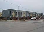
Starrett City (formally known as the Spring Creek Towers) is a housing development in the Spring Creek section of East New York, in Brooklyn, New York City. It is located on a peninsula on the north shore of Jamaica Bay, bounded by Fresh Creek to the west and Hendrix Creek to the east. Starrett City contains both residential and commercial buildings. The residential portion of the property contains eight "sections" in a towers in the park layout. The complex also contains a community and recreation center, as well as two schools. Plans for developing the site of Starrett City date to 1962, when an investment group bought the property with the intention of developing a residential complex called Park Shore Village. The group ultimately withdrew from the project, and another cooperative housing project named Twin Pines Village was proposed by the United Housing Foundation in 1967. Control of the complex was handed to Starrett City Associates in 1971, and Starrett City opened in 1974. The complex assumed the name of Spring Creek Towers in 2002, though it is still popularly known as Starrett City. Starrett City is part of Brooklyn Community District 5, and its primary ZIP Code is 11239. It is patrolled by the 75th Precinct of the New York City Police Department. Politically it is represented by the New York City Council's 42nd District.
Excerpt from the Wikipedia article Starrett City, Brooklyn (License: CC BY-SA 3.0, Authors, Images).Starrett City, Brooklyn
Pennsylvania Avenue, New York Brooklyn
Geographical coordinates (GPS) Address Nearby Places Show on map
Geographical coordinates (GPS)
| Latitude | Longitude |
|---|---|
| N 40.648 ° | E -73.882 ° |
Address
Pennsylvania Avenue
Pennsylvania Avenue
11239 New York, Brooklyn
New York, United States
Open on Google Maps


