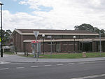
Kings Park, New South Wales
1987 establishments in AustraliaCity of BlacktownPopulated places established in 1987Suburbs of SydneySydney geography stubs ... and 1 more
Use Australian English from February 2015

Kings Park is a suburb of Sydney, in the state of New South Wales, Australia. Kings Park is located 40 km west of the Sydney central business district, in the local government area of the City of Blacktown and part of the Greater Western Sydney region.
Excerpt from the Wikipedia article Kings Park, New South Wales (License: CC BY-SA 3.0, Authors, Images).Kings Park, New South Wales
Donohue Street, Sydney Kings Park
Geographical coordinates (GPS) Address Nearby Places Show on map
Geographical coordinates (GPS)
| Latitude | Longitude |
|---|---|
| N -33.737 ° | E 150.901 ° |
Address
Donohue Street
Donohue Street
2148 Sydney, Kings Park
New South Wales, Australia
Open on Google Maps


