place

Mollie Kathleen Gold Mine

Buildings and structures in Teller County, ColoradoColorado Mining BoomColorado building and structure stubsGold mines in ColoradoHistory of Teller County, Colorado
Mining museums in ColoradoMuseums in Teller County, ColoradoUnderground mines in the United StatesWestern United States museum stubs
MollieKathleenMineCO

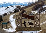
The Mollie Kathleen Gold Mine is a historic vertical shaft mine near Cripple Creek, Colorado. The mine shaft descends 1,000 feet (300 m) into the mountain, a depth roughly equal to the height of the Empire State Building in New York City. The mine currently gives tours, and is visited by around 40,000 people annually. The addition of the mines and subsequent tours of this mine and others in the area had considerable effect on the economies of both Victor, Colorado and Cripple Creek.

Excerpt from the Wikipedia article Mollie Kathleen Gold Mine (License: CC BY-SA 3.0, Authors, Images).

Mollie Kathleen Gold Mine
South State Highway 67,

Geographical coordinates (GPS) Address Nearby Places
placeShow on map

Wikipedia: Mollie Kathleen Gold MineContinue reading on Wikipedia

Geographical coordinates (GPS)

Latitude Longitude
N 38.753055555556 ° E -105.16055555556 °
placeShow on map

Address

Mollie Kathleen Mine

South State Highway 67
80813
Colorado, United States
mapOpen on Google Maps

MollieKathleenMineCO
Share experience

Nearby Places

Cripple Creek Historic District

Cripple Creek Historic District is a historic district including Cripple Creek, Colorado, United States and is significant for its gold mining era history. It developed as a gold mining center beginning in 1890, with a number of buildings from that period surviving to this day. The mines in the area were among the most successful, producing millions of dollars of gold in the 1890s and supporting a population of 25,000 at its peak. It was declared a National Historic Landmark in 1961.Many Cripple Creek buildings post-date the gold mining era. The district includes a number of structures that survive from that era: The Midland Terminal Depot Teller County Courthouse The Imperial Hotel The Old Homestead St. Paul's Catholic Church Mansard Roof House, on Warren Avenue The El Paso County Hospital, a brick Greek Revival-style two-story building.The boundary of the district is defined by high points around Cripple Creek to include the "natural setting reminiscent of the historic environment. Additionally, it encloses part of the extent of Poverty Gulch where some of the original ore discoveries were made as well as the County Hospital building which is located outside the town limits." (p. 10) It runs from the peak of Mineral Hill (elevation 10,255 feet) southwest to a peak (elevation 9,855 feet), then to northeast corner of Mount Pisgah cemetery, then south along the east border of the cemetery to its southeast corner, then southeast to the peak that is 1600 feet to the northwest of Signal Hill (at elevation 9731), then northeast to the summit of Globe Hill (elevation 10,436), then northwest to peak of Carbonate Hill (elevation 10,335), finally east back to the peak of Mineral Hill. State Highway 67 is the principal road through the area.