place

Battle of the Barrier

1840 in China19th century in MacauAugust 1840 eventsBattles of the First Opium WarConflicts in 1840
Military history of MacauNaval battles of the Opium WarsPortuguese Macau
Barrier wall, Macao
Barrier wall, Macao

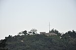
The Battle of the Barrier (Chinese: 澳門之戰) was fought between British and Chinese forces at the boundary separating Macao from the Chinese mainland on 19 August 1840 during the First Opium War. Located in modern-day Portas do Cerco, the Macao Peninsula was connected to Xiangshan Island by a narrow isthmus about 100 m (330 ft) wide and 1.2 km (0.75 mi) long. A wall called the Barrier was built across the isthmus in 1573, and it served as Macao's border.

Excerpt from the Wikipedia article Battle of the Barrier (License: CC BY-SA 3.0, Authors, Images).

Battle of the Barrier
關閘廣場 Praça das Portas do Cerco,

Geographical coordinates (GPS) Address Nearby Places
placeShow on map

Wikipedia: Battle of the BarrierContinue reading on Wikipedia

Geographical coordinates (GPS)

Latitude Longitude
N 22.214722222222 ° E 113.54888888889 °
placeShow on map

Address

關閘廣場 Praça das Portas do Cerco

關閘廣場 Praça das Portas do Cerco
519020 , 關閘 Portas do Cerco
Macau, China
mapOpen on Google Maps

Barrier wall, Macao
Barrier wall, Macao
Share experience

Nearby Places

Mong-Há Fort
Mong-Há Fort

Mong-Há Fort (Chinese: 望廈炮台; Portuguese: Fortaleza de Mong-Há) is a fort on Mong-Há Hill, Nossa Senhora de Fátima, Macau, China. The fort is part of a greater military reservation – the Bairro Militar de Mong-Há, which included the Quartel de Mong-Há (Mong-Há Barracks). The Bairro Militar is bound by the Rua Francisco Xavier Pereira and the Colina de Mong-Há. The main fort complex was erected 1849 by Governor Ferreira do Amaral to protect the Macau's northern sector as precaution against a possible Chinese invasion following the First Opium War between Britain and China (1839–1842). The fort's construction began in 1849 and was completed in 1864/66. The Quartel de Mong-Há was constructed in the 1920s. With the complete withdrawal of the Portuguese military establishment in the 1960s following the Sino-Portuguese rapprochement, the fort and the Bairro Militar were deactivated, with the former being turned over to the Instituto de Formação Turística de Macau in the 1980s. In June 1997, the area surrounding the fort was transformed into the Jardim Municipal de Mong-Há. With an overall area of 650 square meters, the brick-walled fort held ten artillery pieces with a firing range capable of reaching the Portas do Cerco. Along with the barracks for Portuguese troops of African origin (Landins), the fort also included a lookout post and a munitions dump. The Quartel de Mong-Há occupied an area of 2244 square meters and was built in the style of 1920s Southern European and Modernist architecture. The government of Macau demolished the Quartel de Mong-Há and the neighboring Escola Keang Peng and put in their place public housing in the name of public security in late 2008.