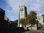
Thorngumbald
Civil parishes in the East Riding of YorkshireHoldernessOpenDomesdayUse British English from October 2013Villages in the East Riding of Yorkshire

Thorngumbald is a village and civil parish in the East Riding of Yorkshire, England, in an area known as Holderness, 8 miles (13 km) east of Hull on the A1033. The civil parish is formed by the village and the hamlets of Camerton and Ryehill. At the 2011 census, it had a population of 3,392, an increase on the 2001 UK census figure of 3,106.
Excerpt from the Wikipedia article Thorngumbald (License: CC BY-SA 3.0, Authors, Images).Thorngumbald
Church Lane,
Geographical coordinates (GPS) Address Nearby Places Show on map
Geographical coordinates (GPS)
| Latitude | Longitude |
|---|---|
| N 53.7208 ° | E -0.1715 ° |
Address
Church Lane
Church Lane
HU12 9PB , Thorngumbald
England, United Kingdom
Open on Google Maps


