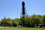
Supawna Meadows National Wildlife Refuge

The Supawna Meadows National Wildlife Refuge is a component of the Delaware River estuary in Salem County, New Jersey, it is just north of the Salem River and south of Pennsville. The Delaware Bay and estuary are wetlands of international importance and an international shorebird reserve. The refuge currently owns approximately 3,000 acres (12 km2) within the 4,600-acre (19 km2) approved boundary. The brackish water tidal marshes and coastal forests that make up nearly 80 percent of the refuge provide waterfowl with a feeding and resting area, particularly during the fall and spring migrations. American black ducks, mallards and northern pintails are common winter visitors. Sandpipers and other shorebirds use the refuge marshes as a feeding area during the summer as well as during the spring and fall migrations. The rookery at nearby Pea Patch Island hosts over 6,000 pairs of nine species, making it the largest rookery of colonial wading birds on the east coast north of Florida. The refuge marshes provide valuable foraging habitat for these colonial wading birds during the nesting season. Warblers, sparrows and other migratory birds use the upland areas of the refuge as resting and feeding areas during migration and for nesting during the summer. Thousands of tree swallows forage on the refuge in the late summer. Ospreys, bald eagle, northern harrier, short-eared owl and barn owl nest on the refuge. Supawna meadows lies in the Southeastern mixed forests ecoregion. There are stands of southern wild rice here too.
Excerpt from the Wikipedia article Supawna Meadows National Wildlife Refuge (License: CC BY-SA 3.0, Authors, Images).Supawna Meadows National Wildlife Refuge
Christmas Tree Lane,
Geographical coordinates (GPS) Address Nearby Places Show on map
Geographical coordinates (GPS)
| Latitude | Longitude |
|---|---|
| N 39.62566 ° | E -75.52603 ° |
Address
Christmas Tree Lane
Christmas Tree Lane
08070
New Jersey, United States
Open on Google Maps


