Häcklingen
Lüneburg
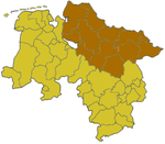
Häcklingen is a village in the municipality of Lüneburg, about 6 km from the town centre. Formerly an independent municipality, it is part of the town Lüneburg since 1974. It has an area of 4.997 hectares (12.35 acres) and is bordered to the west by Rettmer. To the north it is separated from the district of Bockelsberg by a small wood, to the east it is bordered by Uelzener Straße (the old B 4 highway). The next nearest village to the south is Melbeck. Chair of the council is Dr. Uwe Plath (CDU); he followed Susanne Pulsfort (CDU) who had been in the post for many years.
Excerpt from the Wikipedia article Häcklingen (License: CC BY-SA 3.0, Authors).Häcklingen
Hauptstraße,
Geographical coordinates (GPS) Address Nearby Places Show on map
Geographical coordinates (GPS)
| Latitude | Longitude |
|---|---|
| N 53.210555555556 ° | E 10.391944444444 ° |
Address
Hauptstraße 15
21335 , Häcklingen
Lower Saxony, Germany
Open on Google Maps


