Lüneburg Kalkberg
Hills of Lower SaxonyLüneburg

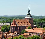
The Lüneburg Kalkberg (not to be confused with the Segeberger Kalkberg) is the cap rock of a salt dome in the western part of the German town of Lüneburg. The Kalkberg was a gypsum mine during the middle ages, but is today a Naturschutzgebiet (nature reserve) and a common meeting place for city residents.
Excerpt from the Wikipedia article Lüneburg Kalkberg (License: CC BY-SA 3.0, Authors, Images).Lüneburg Kalkberg
Schnellenberger Weg,
Geographical coordinates (GPS) Address Website Nearby Places Show on map
Geographical coordinates (GPS)
| Latitude | Longitude |
|---|---|
| N 53.249444444444 ° | E 10.396388888889 ° |
Address
Kalkberg
Schnellenberger Weg
21339 , Weststadt
Lower Saxony, Germany
Open on Google Maps


